
The wine atlas
Map credits
Our wine maps bring together geography from public agencies, wine organisations and open-data contributors. Their sources and licences are listed below.
Shared geography
Natural Earth
Public domain. Country, land and water geography is projected, clipped and simplified for display.
Map shapes are adapted for display, including projection, clipping and simplification. Regional notes retain the source’s qualifications and any earlier modifications. These maps help you explore wine regions; they do not establish vineyard eligibility or surveyed boundaries.
Each source retains its own terms. A licence listed for one dataset does not apply to other material. Where no licence is recorded, no additional reuse permission is implied.
Abruzzo
Back to index ↑© ISTAT · CC BY 4.0
Municipal unions; simplified
Natural Earth
Public domain
ISTAT administrative boundaries, 1 January 2026
CC BY 4.0
Aconcagua
Back to index ↑Biblioteca del Congreso Nacional de Chile
Reference boundaries
Natural Earth
Public domain
Decree 464, Article 1(3), consolidated 14 July 2026
Current named administrative definitions; Lo Abarca locality perimeter unresolved.
BCN Mapoteca administrative reference compilation
Free use with attribution to Biblioteca del Congreso Nacional de Chile. Referential, not geodetic.
Aegean Islands
Back to index ↑ELSTAT · 2011 reference geography
Adapted; ELSTAT is not responsible for this map
Natural Earth
© Landwirtschaftskammer RLP (2026)
dl-de/by-2-0 · Daten bearbeitet
©GeoBasis-DE / LVermGeoRP (2026)
dl-de/by-2-0 · Daten bearbeitet
© OpenStreetMap contributors
Natural Earth
Alentejo
Back to index ↑Eurostat / GISCO, Local Administrative Units 2024
© EuroGeographics for the administrative boundaries; © European Union, Eurostat, GISCO
Municipality groups locate subregions; they are explicitly context, not legal wine boundaries. Vidigueira follows Alvito, Cuba and Vidigueira. Granja-Amareleja includes Mourão and Amareleja/Póvoa de São Miguel parishes but is still context because the legal boundary also follows a river segment.
Candiago et al., Wine PDO map
CC BY 4.0
PDO-PT-A1542 regional orientation only; research geometry rather than authoritative vineyard delimitation.
Portaria 296/2010, geographic definitions
2026-09-27
Natural Earth
Public domain
Alsace
Back to index ↑INAO
Natural Earth
INAO published digital parcel production boundaries
Licence Ouverte / Open Licence
Cadastral production outlines; informative published data. Official delimitation plans held by municipalities or INAO have legal authority. Source parcels retain 2 metre simplification for coverage and overlap checks; drawn areas use separate cartographic grouping, not legal parcel boundaries.
2026-10-12
2026-10-14
INAO geographical areas (coverage cross-check only)
Open Licence 2.0
Commune production geography, not rendered as a vineyard boundary.
2026-10-12
2026-10-14
Natural Earth countries and Rhine
Public domain
1:10 million contextual geography
2026-10-14
Natural Earth Europe river supplement (French Ill)
Public domain
Contextual river centre line, clipped to map extent.
5.0.0
2026-10-14
French government Geo API municipality centres
Open Licence 2.0
Municipality centres for orientation; not wineries or vineyard sites.
2026-10-14
Baden
Back to index ↑© Regierungspräsidium Freiburg, LGRB
16 Oct 2026
LGL · dl-de/by-2-0
Register
Cadastre
dl-de/by-2-0
Natural Earth
Public domain
Legal Specification
Current PDO is parcel-delimited. Site unions are registered-site context, not certification of the complete current PDO.
District Cadastre
dl-de/by-2-0
2026-10-16
Balaton
Back to index ↑Basilicata
Back to index ↑Beaujolais
Back to index ↑© IGN
INAO geographical production areas
lov2
Informative INAO digitised representation; legal originals are the specifications (geographical area) and plans deposited at INAO/mairies (parcel area).
2026-10-12
INAO digitised AOC vineyard parcel delimitation
fr-lo
Informative INAO digitised representation; legal originals are the specifications (geographical area) and plans deposited at INAO/mairies (parcel area).
2026-10-12
IGN BD TOPO river network
© IGN
Open Licence 2.0
2026-10-14
Natural Earth 1:10m country outlines
Public domain
French government API Découpage administratif town-hall points
Open Licence 2.0 (IGN ADMIN EXPRESS-derived administrative reference data via DINUM)
Official town-hall reference points for contextual city labels; not municipality centres, urban outlines or wine GI boundaries.
Bordeaux
Back to index ↑INAO geographical production areas
Open Licence 2.0
British Columbia
Back to index ↑Bugey
Back to index ↑Burgenland
Back to index ↑© BEV 2026
Land Burgenland
CC BY 4.0 · adapted
Natural Earth
BEV; Land Burgenland
CC BY 4.0
Administrative legal-unit unions. Municipalities and incomplete Leithaberg/historical context remain qualified. Full source geometry is retained separately from generalized displayGeometry.
2026-10-15
Inputs
CC BY 4.0
2026-04-01
2026-10-15
Inputs
CC BY 4.0
2026-10-09
2026-10-15
Natural Earth
Public domain
Inputs
2026-10-15
Inputs
2026-10-15
Inputs
5.0.0
2026-10-15
Burgundy
Back to index ↑INAO geographical production areas
Open Licence 2.0
Calabria
Back to index ↑ISTAT
CC BY 4.0
GeoNames
CC BY 4.0
Reggio Calabria
Natural Earth
California
Back to index ↑UC Davis AVA Digitizing Project
CC0
Digitized AVA boundaries for education; codified TTB descriptions control.
US Census 2024 cartographic boundaries
Public domain
Generalized county/state boundaries; counties are not AVAs.
Natural Earth countries
Public domain
Campania
Back to index ↑ISTAT 1 January 2026 administrative geography; current MASAF Article 3 recipes
CC BY 4.0
Generalized geographical extents, not eligible vineyard parcels. Six unresolved partial zones are excluded.
Regione Campania open road/water network and CTR2020 surveyed Piana junction
CC BY 4.0
Natural Earth
Public domain
Catalonia
Back to index ↑ICGC
CC BY 4.0 · 2026
INCAVI
2026
Catastro
2026 derivative
IDAPA / UdL
2021
Central Otago
Back to index ↑IPONZ registered wine GIs
Official NZGD2000 shapefile transformed to WGS84 and simplified by 0.001 degrees.
2026-09-26
IPONZ registered wine GIs
Official NZGD2000 shapefile transformed to WGS84 and simplified by 0.001 degrees.
2026-09-26
Central Otago Winegrowers subregion context
Gibbston editorial orientation point; not a legal boundary or vineyard location.
Natural Earth countries, lakes and rivers
Public domain
New Zealand inset includes North, South and Stewart Islands; remote islands omitted.
Central Valley
Back to index ↑Biblioteca del Congreso Nacional de Chile
Natural Earth
Public domain
Ruta del Vino Cachapoal — indicative sector
Decree 464, Article 1, consolidated 2026-07-14
Current named-unit definitions illustrated with referential administrative geometry. Missing wine-area extents remain blocked; Teno commune is context, not the larger legal zone.
Biblioteca del Congreso Nacional de Chile — administrative reference geometry
BCN Mapoteca permits free use with source attribution. Referential mapping; not for geodetic work.
Older official reference compilation, EPSG:3857 transformed to WGS84, topology repair/union and topology-preserving six-decimal precision grid (approximately 0.1 m, not a positional accuracy claim). Current Decree 464 named-unit compositions are illustrated, not surveyed current legal edges. Source vertices remain separate from generalized display geometry.
Ruta del Vino Cachapoal — Cachapoal Andes
Natural Earth reference points are public domain. Publisher raster retained privately as research evidence; artwork is not bundled or copied into the runtime. No open licence or publisher approval for this interpreted outline is asserted; source and derivation are explicit.
Approximate city-label registration, small raster, and schematic publisher edges. Fit residual measures registration consistency only, not geographical boundary accuracy. No accuracy finer than 5 km is claimed.
Champagne
Back to index ↑INAO geographical production areas
Open Licence 2.0
2026-09-21
Natural Earth countries and rivers
Public domain
French government Geo API municipality centres
Open Licence 2.0
2026-10-08
Union des Maisons de Champagne district commune lists
2026-10-12
IGN / data.gouv.fr commune and delegated-commune contours, 100 m
ODbL 1.0
2025
Corsica
Back to index ↑Crete
Back to index ↑ELSTAT · 2011 reference geography
Adapted; ELSTAT is not responsible for this map
Natural Earth
Dalmatia
Back to index ↑Douro
Back to index ↑© OpenStreetMap contributors
GeoNames
IVDP demarcated region and subregions
2026-10-13
Natural Earth country outlines
Public domain
OpenStreetMap river centre lines
ODbL
2026-07-28T02:16:18Z
GeoNames Portugal gazetteer
CC BY 4.0
2026-10-13
Emilia-Romagna
Back to index ↑Regione Emilia-Romagna, individual production-zone maps
CC BY 4.0
2026-10-15
ISTAT administrative geography, 2026 and pre-merger Bazzano/Crespellano 2013
CC BY 4.0
Regione Emilia-Romagna technical cartography, public ARPAE raster service
CC BY 4.0
2026-10-15
Comune di Rimini, road functional classification
CC BY 4.0 (publisher default; item has no different licence)
Natural Earth
Public domain
Flanders
Back to index ↑Franken
Back to index ↑Datenquelle: Bayerische Vermessungsverwaltung – www.geodaten.bayern.de
CC BY 4.0 · modified
Regierung von Unterfranken
Natural Earth
Friuli Venezia Giulia
Back to index ↑ISTAT · CC BY 4.0
Wine PDO map · CC0
Natural Earth
Public domain
© OpenStreetMap contributors · ODbL
Candiago et al. (2022), Wine PDO map
CC0
Municipality-level orientation areas, November 2021 inventory; not exact production boundaries or vineyard parcels
ISTAT administrative boundaries, 1 January 2026
CC BY 4.0
Carso Article 3 open itinerary reconstruction
ODbL 1.0
Latisana Article 3 open itinerary reconstruction
ODbL 1.0
Isonzo Article 3 independent itinerary reconstruction
ODbL 1.0; ISTAT CC BY 4.0
Ramandolo Article 3 independent itinerary reconstruction
ODbL 1.0; cited primary geographic facts
Open Database License 1.0
Independently reconstructed itinerary linework is ODbL; original source attribution and rights remain recorded separately.
Jura
Back to index ↑INAO geographical production areas
Open Licence 2.0
2026-10-12
IGN BD TOPO rivers
Open Licence 2.0
French government town-hall points
Open Licence 2.0
Natural Earth countries
Public domain
Kakheti
Back to index ↑National Wine Agency · NAPR / NSDI
GeoNames
CC BY 4.0
National Wine Agency · microzones of protected designations of origin
Official vector map exports registered to their UTM 38N extents; specification-map checks recorded separately.
2026-10-16
Sakpatenti state register and current production specifications
2026-10-16
GeoNames Georgia
CC BY 4.0
Settlement locations only; no wine boundaries inferred.
National Agency of Public Registry · River and Canal
Digitised hydrographic centrelines; no field-instrumental verification.
2026-10-16
Natural Earth 5.1.2
Public domain
Languedoc-Roussillon
Back to index ↑INAO geographical production areas
Open Licence 2.0
2026-10-12
IGN BD TOPO hydrographic main-flow segments
Open Licence 2.0
2026-10-13
Natural Earth 1:10m countries
Public domain
Lazio
Back to index ↑Liguria
Back to index ↑Regione Liguria
CC BY 4.0
ISTAT
CC BY 4.0
Agenzia delle Entrate
CC BY 4.0
Regione Toscana — GEOscopio
CC BY 4.0
GeoNames
CC BY 4.0
Natural Earth
Loire Valley
Back to index ↑INAO geographical production areas
Open Licence 2.0
Geographical production areas for orientation; not planted vineyard parcels. Official geographic definitions remain in the appellation specifications.
2026-10-12
IGN BD TOPO river network
© IGN
Open Licence 2.0
2026-10-13
Natural Earth country outlines
Public domain
Lombardy
Back to index ↑Open Wine Map
CC BY-SA 4.0
Regione Lombardia / Provincia di Brescia
CC BY 4.0
ISTAT
CC BY 4.0
OpenStreetMap contributors
ODbL 1.0
Candiago et al. Wine PDO map (November 2021 inventory)
CC0
Municipality-level approximations, not exact production boundaries or vineyards
ISTAT administrative boundaries, 1 January 2026
CC BY 4.0
Natural Earth
Public domain
Marche
Back to index ↑© ISTAT · CC BY 4.0
2026 administrative geography
Natural Earth
ISTAT boundaries, 1 January 2026
CC BY 4.0
IMT published production specifications, Article 3
Marlborough
Back to index ↑IPONZ Marlborough GI1004
No redistribution/adaptation grant established for this IP register geometry. Do not label this boundary CC BY or publish until reuse permission is resolved.
Full registered GI including Kaikōura; repaired source rings, simplified in NZTM metres. See retained geography evidence for measured displacement.
2026-10-15
LINZ New Zealand Gazetteer towns and rivers
Contains data sourced from the LINZ Data Service and licensed for reuse under CC BY 4.0.
CC BY 4.0
Official geographic reference points and channel shapes, generally 1:50,000 mapping precision; not wine-area boundaries.
2026-10-15
Appellation Marlborough Wine – Subregions of Marlborough, 2023
Publisher-defined wine-growing subregions, not registered sub-GIs or vineyard parcels. Wairau includes Southern Valleys; Awatere excludes Blind River.
2026-10-15T02:18:45.886462+00:00
Natural Earth land context
Public domain
Existing generalized Natural Earth context only. It is not a legal GI source. Historical raw source version was not recorded; this exact checked-in subset is retained for offline reproducibility.
Mendoza
Back to index ↑COVIAR
IGN
Source
Public free-access data; ArcGIS service copyrightText and item licenseInfo do not specify a reuse licence. Retain COVIAR attribution.
Study-area orientation outline; not a GI boundary or exhaustive planted-vineyard census
2026-10-14
Source
Public free-access data; ArcGIS service copyrightText and item licenseInfo do not specify a reuse licence. Retain COVIAR attribution.
Study-area orientation outline; not a GI boundary or exhaustive planted-vineyard census
2026-10-14
Source
Public free-access data; ArcGIS service copyrightText and item licenseInfo do not specify a reuse licence. Retain COVIAR attribution.
Study-area orientation outline; not a GI boundary or exhaustive planted-vineyard census
2026-10-14
Source
Public free-access data; ArcGIS service copyrightText and item licenseInfo do not specify a reuse licence. Retain COVIAR attribution.
Study-area orientation outline; not a GI boundary or exhaustive planted-vineyard census
2026-10-14
Source
Public domain
Country/regional locator context only. Natural Earth river lines superseded by fresh official IGN hydrography.
Source
Public official legal-coordinate data; no geodetic datum stated by published instrument
Legal-coordinate display reconstruction of the added polygon; joins listed sequential vertices. Road/dry-stream courses between listed points are screen-generalized. Not a legal survey. The 2017 district outline must also remain.
2026-10-14
Source
Official public IGN hydrography. Parent service copyright is IGN. The watercourse layer does not publish a specific reuse licence; retain IGN attribution. Do not apply an unrelated layer licence to this dataset.
Official ANIDA watercourse centerlines for Río Mendoza, Tunuyán, Diamante, Atuel and Desaguadero. Geographic context only; not legal riverbank/GI survey.
2026-10-14
INV Los Chacayes 2023 expansion
Official legal coordinates
Legal-coordinate display reconstruction of the added polygon; joins listed sequential vertices. Road/dry-stream courses between listed points are screen-generalized. Not a legal survey. The 2017 district outline must also remain.
2026-10-14
Minho
Back to index ↑Eurostat / GISCO, Local Administrative Units 2024
© EuroGeographics for the administrative boundaries; © European Union, Eurostat, GISCO
Union of official parish polygons following Vinho Verde legal definitions; simplified orientation, not vineyard plots.
Portugal Portaria 152/2015, republished articles 2–3
2026-09-27
IVV Vinho Verde specification, January 2024
2026-09-27
Natural Earth
Public domain
Moravia
Back to index ↑Mosel
Back to index ↑© Landwirtschaftskammer RLP (2023)
Registered wine-growing sites, simplified; not planted parcels or a complete Mosel PDO boundary. Saarland is not covered. Village highlights use exact cadastral-name matches and omit cross-village records.
dl-de/by-2-0
Natural Earth
Public domain
Nahe
Back to index ↑© Landwirtschaftskammer RLP (2026)
dl-de/by-2-0 · Daten bearbeitet
© OpenStreetMap contributors
Natural Earth
New South Wales
Back to index ↑© Wine Australia
CC BY 4.0
Natural Earth
Public domain
1:10m state, land, cities and river context. State boundaries are not GI evidence.
Wine Australia Geographical Indications of Australia
CC BY 4.0
Official spatial interpretations. Textual GI definitions prevail. No server generalization or coordinate rounding. Separate displayGeometry prepared by generalize-map-display.py.
New York
Back to index ↑TTB AVA boundaries
Reference outlines; 27 CFR part 9 defines the legal boundaries.
Natural Earth
Public-domain land, lakes and river context.
Niederösterreich
Back to index ↑© BEV 2026
Land Niederösterreich
CC BY 4.0 · adapted
Natural Earth
BEV — Verwaltungsgrenzen, Stichtag 01.04.2026
© BEV 2026 — CC BY 4.0; geographic unions and simplification by Genuine Grape
CC BY 4.0
Independent legal administrative geographic area reconstruction. Native cadastral administrative boundaries; not a planted-vine footprint or parcel certification. Municipal/cadastral/historical substitutes remain explicitly qualified context.
2026-04-01
2026-10-14
Inputs
2026-10-14
Inputs
2026-10-14
Land Niederösterreich — enacted Weinbau Rieden
Datenquelle: Land Niederösterreich — data.noe.gv.at; geographic unions and simplification by Genuine Grape
CC BY 4.0
Current enacted geographic Ried outer areas selected by exact feature IDs and numeric KGNR under the Kamptal DAC Annex. All listed Langenlois, Zöbing and Straß core/sub-Ried memberships resolved; retains disconnected areas. The statewide dataset remains project work outside these verified scopes.
2026-10-10
2026-10-14
Inputs
2026-10-14
Inputs
2026-10-14
Inputs
2026-10-14
Austrian RIS — current Wine Act and DAC geographical definitions
Exact legislative administrative memberships in geometry-definitions.json and legal-village-definitions.json. Wagram DAC §1 is distinguished from broader generic Wine Act §21. Blend tolerances do not expand the drawn core area.
2026-10-14
Natural Earth — countries and major river context
Public domain
1:10 million country locator/coastline, major rivers and Vienna capital point context, further simplified for display. This river source scale omits Kamp, Traisen and Thaya; no handwritten replacement path is inserted.
2026-10-14
Inputs
2026-10-14
Inputs
2026-10-14
Inputs
2026-10-14
Northern Greece
Back to index ↑AUA GIS Research Unit
PDO research zones
GeoNames
Location references · CC BY 4.0
Natural Earth
Public domain
Ontario
Back to index ↑Ontario
Contains information licensed under the Open Government Licence – Ontario.
NRCan
Natural Earth
Oregon
Back to index ↑TTB American Viticultural Areas, current established boundaries
TTB download conditions: no fee and no restrictions on use
Official educational/reference GIS; codified TTB descriptions control. Yamhill-Carlton is outer-envelope context only; source omits the 200–1,000ft elevation exclusions.
2026-10-15
UC Davis AVA Digitizing Project, legacy comparison only
CC0-1.0
Independent legacy digitization retained as comparison evidence; not the displayed AVA source.
2026-10-15
US Census 2024 states 1:500,000
Public domain, US federal government
Generalized state context, never an AVA perimeter or clipping mask.
2026-10-15
Natural Earth v5.1.2 countries, rivers and populated places
Public domain
1:10m reference geography; river/town source IDs and Columbia part-level provenance are recorded separately. Locator shows contiguous US. Columbia uses64River plus only103River part0(Pasco→Wallula); the other four103River parts are Snake and excluded. Source endpoint gaps remain; no invented joins or tidal-estuary extension.
2026-10-15
Peloponnese
Back to index ↑GeoNames
Town references · CC BY 4.0
Natural Earth
Public domain
Pfalz
Back to index ↑© Landwirtschaftskammer RLP (2026)
dl-de/by-2-0
[Daten bearbeitet]
© Landwirtschaftskammer RLP (2026)
Registered sites; shared sites retained in full. Not planted parcels, a complete PDO outline or VDP holdings.
dl-de/by-2-0
2026-08-11
Natural Earth countries, Rhine and city reference points
Public domain
1:10 million contextual geography
Piedmont
Back to index ↑Regione Piemonte — Aree di produzione vini DOC e DOCG
CC BY 4.0
Natural Earth
Public domain
Priorat
Back to index ↑MAPA: Zonas de Calidad Diferenciada, Vinos
CC BY 4.0 (IDE metadata)
Municipality-level wine zones. Original overlaps retained; no claim to parcel boundaries.
2026-09-26
Natural Earth
Public domain
Provence
Back to index ↑INAO geographical production areas
lov2
2026-10-12
INAO digitised AOC vineyard parcel delimitation
fr-lo
2026-10-12
Natural Earth 1:10m country outlines
Public domain
Natural Earth 1:10m rivers
Public domain
Puglia
Back to index ↑Regione Puglia
ISTAT
Natural Earth
Regione Puglia — SIT wine production areas
Not declared by the wine GIS service; reuse permission unresolved
Official geographical production-area outlines; source update date, survey accuracy and scale are not published. Not vineyard parcels or proof of eligibility.
ISTAT administrative boundaries, 1 January 2026
CC BY 4.0
Generalized municipalities and provinces; Article 3 whole-territory reconstructions, not vineyard parcels.
MASAF current DOP/IGP registers and specifications
Official regulatory texts, cited for scope
Candiago et al. Wine PDO map — superseded
CC0
Legacy municipality-level orientation approximations, not exact production boundaries. No longer supplies Puglia geometry.
Natural Earth 1:10m — admin 0 countries
Public domain
Small-scale orientation context; not GI boundaries.
Natural Earth 1:10m — rivers lake centerlines
Public domain
Small-scale orientation context; not GI boundaries.
Natural Earth 1:10m — populated places
Public domain
Small-scale orientation context; not GI boundaries.
Quebec
Back to index ↑Rheingau
Back to index ↑Hessische Verwaltung für Bodenmanagement und Geoinformation, cadastral boundaries
dl-de-zero-2-0
Actual cadastral boundaries used only as village context, not vineyard boundaries.
2026-09-26
Candiago et al., WinePDOmap
CC0
Municipality-level Rheingau PDO orientation. Not parcel boundaries.
Natural Earth
Public domain
Rheinhessen
Back to index ↑© Landwirtschaftskammer RLP (2026), dl-de/by-2-0
[Daten bearbeitet]
© GeoBasis-DE / LVermGeoRP (2026)
dl-de/by-2-0 [Daten bearbeitet]
Register
© Landwirtschaftskammer RLP (2026), dl-de/by-2-0, weinlagen.lwk-rlp.de [Daten bearbeitet]
dl-de/by-2-0
2026-08-11
Ne 10m Admin 0 Countries
Public domain
Ne 10m Populated Places
Public domain
Ne 10m Rivers Lake Centerlines
Public domain
Cadastre
©GeoBasis-DE / LVermGeoRP (2026), dl-de/by-2-0, http://www.lvermgeo.rlp.de [Daten bearbeitet]
dl-de/by-2-0
2026-10-14
Rhône Valley
Back to index ↑INAO geographical production areas
Open Licence 2.0
2026-10-12
Natural Earth countries and rivers
Public domain
Rías Baixas
Back to index ↑Xunta de Galicia, Instituto de Estudos do Territorio; parish cartography February 2026
Cartografía cedida por © Instituto de Estudos do Territorio. Xunta de Galicia
CC-BY 4.0 compatible; https://mapas.xunta.gal/es/ayuda
2026-09-26
2024 Rías Baixas specification, section 4
Natural Earth 1:10m
Public domain
Ribera del Duero
Back to index ↑Atlas Agroclimático de Castilla y León · ITACYL–AEMET
2013 · CC BY-SA 3.0 ES; wine-area data 2020, simplified.
ITACyL Atlas Agroclimático: Figuras de calidad del vino
CC BY-SA 3.0 ES
Publisher wine-area cartography. Indicative extent, not a legally certified or vineyard-parcel boundary.
2020-08-13
2026-10-15
Natural Earth
Country, land, river and approximate town orientation retained from the existing regional asset.
Public domain
Río Negro
Back to index ↑Rioja
Back to index ↑IGN INSPIRE administrative units; section 4 Rioja specification (15 February 2024)
Obra derivada de BDLJE CC-BY 4.0 ign.es
CC BY 4.0
Municipal administrative context, never vineyard parcel boundaries.
2026-10-13
Natural Earth 1:10m countries
Public domain
Generalised national locator and land context.
IGN IGR Hydrography v0, named Río Ebro WatercourseLink
Obra derivada de IGR-Hidrografía CC-BY 4.0 scne.es
CC BY 4.0
River centreline context, never a legal GI boundary.
2026-10-13
Salta
Back to index ↑Sardinia
Back to index ↑Candiago et al. Wine PDO map (November 2021 inventory)
CC0
Municipality-level approximations, not exact production boundaries or vineyards
ISTAT administrative boundaries, 1 January 2026
CC BY 4.0
Natural Earth
Public domain
Savoie
Back to index ↑INAO · IGN
Source
Open Licence 2.0
2026-10-12
Source
Open Licence 2.0
Source
Open Licence 2.0
Natural Earth
Public domain
Sicily
Back to index ↑© ISTAT
CC BY 4.0
© Regione Siciliana / Agenzia delle Entrate
CC BY 4.0
MASAF current consolidated DOP A–D specifications
Official legal texts; no geometry licence implied
MASAF current consolidated DOP E–N specifications
Official legal texts; no geometry licence implied
MASAF current consolidated DOP O–Z specifications
Official legal texts; no geometry licence implied
MASAF current consolidated IGT specifications
Official legal texts; no geometry licence implied
ISTAT administrative boundaries 1 January 2026
CC BY 4.0
Generalized administrative cartography; not vineyard parcels
Administrative scope reconstruction where the official wine specification defines whole territory; context only for partial municipalities. ISTAT cartography is valid for statistical purposes and is not a legal survey.
Agenzia delle Entrate / Regione Siciliana SITR, cadastral sheets
CC BY 4.0 (SITR open-data terms; source attribution required)
Official sheet geometry; reconstruction from Article 3 memberships is not a legal survey
Fetches
Fetches
Fetches
Fetches
Fetches
Fetches
Fetches
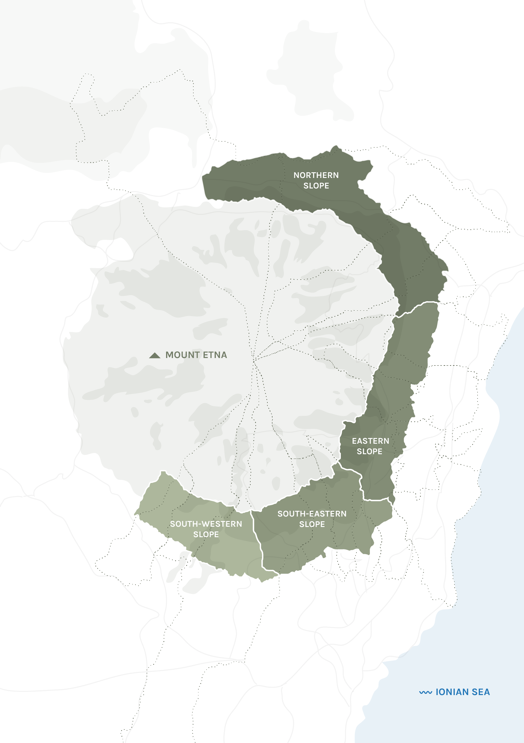
Consorzio Tutela Vini Etna DOC production/contrade map
No reusable georeferenced geometry licence found; reference only, not copied
Fresh primary geographic cross-check; raster has no georeferencing and cannot replace legal delimitation
Gazzetta Ufficiale, Erice recognition proposal and Colli Ericini replacement
Official legal text
IRVO historical Salemi specification Article 3
Official legal text
Commission Implementing Regulation EU 2026/1043
Published 13 May 2026; Article 2 enters into force on the twentieth day following publication, 2 June 2026.
Official legal text
Gazzetta Ufficiale, Terre Siciliane IGT recognition 2011
Official legal text
ISTAT administrative changes 2017–2026: Tripi renamed Tripi - Abakainon on 2025-06-13
Official administrative text
Reconcile legal specification name Tripi with unchanged ISTAT code 083100 in the 2026 geographic source.
Regione Siciliana — CTR 2012–2013
CC BY 4.0
Official 1:10,000 topographic context, historical 2012–13 survey. Named river reaches only; city points are cartographic toponyms, not surveyed town-hall positions.
Regione Siciliana — CTR 2012–2013
CC BY 4.0
Official 1:10,000 topographic context, historical 2012–13 survey. Named river reaches only; city points are cartographic toponyms, not surveyed town-hall positions.
Natural Earth, country/land context
Public domain
Country/locator context only
Fetch
South Australia
Back to index ↑Wine Australia geographical indications
CC BY 4.0
Official spatial interpretation of GI descriptions; all GI vertices retained and coordinates rounded to six decimals. Legal textual definitions prevail; not vineyard parcels.
2026-10-13
Natural Earth countries and rivers
Public domain
1:10m contextual coastline and river centreline source; not legal GI boundaries.
2026-10-13
Southern Region, Chile
Back to index ↑Steiermark
Back to index ↑Sud-Ouest
Back to index ↑INAO geographical production areas
All 29 exact denomination matches. Informational geographical production territories, not vineyard parcels or proximity vinification areas. Source features and disconnected components retained; no clipping to administrative region. Homologated specifications remain authoritative.
Open Licence 2.0
2026-10-12
Natural Earth countries and rivers
Public domain
Tasmania
Back to index ↑© State of Tasmania · © Wine Australia
Indicative growing areas; GI context CC BY 4.0.
Geographical Indications of Australia, © Wine Australia
CC BY 4.0
Regulator graphical interpretation, source geometry simplified 0.0005 degrees with conflicting components retained at original precision; all 5,887 source components retained. Legal text prevails. Source omits remote Macquarie Island; no legal completeness inferred.
2026-10-15
Tasmanian Viticultural Soils and Geology Map
Indicative 2009 published growing-area curves on a generalized geological map, not legal or parcel boundaries. Registration fits the printed grid within 100m, but perimeters and coast joins carry kilometre-scale uncertainty; allow at least 2km. Does not determine origin eligibility. No claim of a 2026 surveyed delimitation.
2026-10-15
Crown copyright reserved; non-commercial reproduction under Tasmanian Government website policy; commercial reuse requires permission.
State of Tasmania and named contributors
Local research/preview derivative. Commercial website publication requires explicit permission from the relevant agency; do not apply the Wine Australia ArcGIS CC BY licence to these separate area outlines.
Wine Tasmania growing-area orientation
Names and relative locations inform editorial approximate points, not settlement centres, vineyards or legal perimeters. Publisher artwork not reproduced.
2026-10-15
Natural Earth 5.1.2 countries and rivers
Public domain
Tokaj
Back to index ↑Official 2019 cadastre map · LTK / MBFSZ
OpenStreetMap · ODbL
GeoNames · CC BY 4.0
362/2019 Government Decree, Annex 2
Archived raster vineyard-cadastre context, georeferenced and colour-classified; not a verified current PDO perimeter. At least 150m edge uncertainty.
2019-12-30
2026-10-18
Ministry Tokaj PDO specification version 10
OpenStreetMap
ODbL 1.0
Municipal outlines only register the historical raster; river context.
GeoNames Hungary
CC BY 4.0
Approximate settlement reference points.
Natural Earth
Public domain
Country and land context.
Trentino-Alto Adige
Back to index ↑Autonomous Province of Bolzano: DOC and IGT geographic zones
CC0 1.0
ISTAT generalized statistical administrative boundaries, 1 January 2026
CC BY 4.0
ISTAT generalized statistical administrative boundaries, 1 January 2015
CC BY 4.0
ISTAT generalized statistical administrative boundaries, 1 January 2009
CC BY 4.0
Candiago et al. Wine PDO map (municipal context only)
CC0 1.0
Bolzano watercourses and Trento principal hydrography
CC0 1.0
Natural Earth 1:10m country, river and lake context
Public domain
Autonomous Province of Bolzano: Lago di Caldaro hydrography
CC0 1.0
Tuscany
Back to index ↑Regione Toscana — GEOscopio
Wine production areas; transformed and simplified for display.
CC BY 4.0
8 May 2026
Umbria
Back to index ↑© Regione Umbria · CC BY 4.0
Adapted; simplified
Natural Earth
Upper Hungary
Back to index ↑Veneto
Back to index ↑Candiago et al. (2022), Wine PDO map
CC0
Municipality-level orientation areas, inventory as of November 2021; not exact vineyard or production boundaries
ISTAT administrative boundaries, 1 January 2026
CC BY 4.0
Natural Earth
Public domain
Victoria
Back to index ↑Wine Australia geographical indications
CC BY 4.0
Official spatial interpretations of textual GI definitions, requested without server generalization; adjoining GI edges retain original source vertices, isolated arcs simplified 0.00003 degrees, coordinates rounded to seven decimals. Audited displacement below 5 m. Muted regional context union simplified 0.0003 degrees. Textual descriptions remain the legal definitions; not vineyard parcels.
2026-10-13
Natural Earth land, rivers, Australia river supplement and Melbourne
Public domain
1:10 million contextual cartography, not GI boundaries. Land simplified 0.0003 degrees, rivers 0.0001 degrees; country inset 0.012 degrees.
2026-10-13
Washington
Back to index ↑TTB AVAs_Production
No restrictions on use; AVAs_Production service item licenseInfo
Regulator informational AVA digitization; codified 27 CFR part 9 controls; not vineyard parcels.
US Census 2024 state cartographic boundaries
Public domain
Generalized state boundary for regional orientation.
Natural Earth countries
Public domain
Western Australia
Back to index ↑© Wine Australia
CC BY 4.0
Boundaries simplified for display
Natural Earth
Geographical Indications of Australia, © Wine Australia
CC BY 4.0
Official spatial interpretation of legal textual definitions; unmodified source coordinates retained for selection/framing. Separate rendering outline simplified 10 m in EPSG:7850 and rounded to six decimal places. Not vineyard parcels or legal definitions.
2026-10-14
Natural Earth 5.1.2 countries, rivers and towns
Public domain
Generalised 1:10 million cartographic context. Never used to establish wine identity or GI boundaries.
2026-10-14
Western Cape
Back to index ↑VinPro / SAWIS Wine of Origin geographical units
VinPro in collaboration with SAWIS
No explicit licence stated in public item metadata
Official WO polygons; display simplification 0.0004 degrees (about 44.5m north-south), topology-preserving 0.0000001-degree grid (about 0.011m north-south; coordinate encoding precision, not source survey accuracy). Eight names show wider context, not invented legal boundaries.
2026-06-26
2026-10-13
SANBI / DWS NBA 2018 river reaches, Western Cape Government GIS
SANBI, DWS
No explicit licence stated in public service metadata
Medium-scale orientation lines; named reaches merged, clipped to overview plus 0.3 degrees, simplified to 0.0001 degrees. Bree displayed as Breede; Gourits as Gouritz. Only western Olifants selected. Not survey or riparian boundaries.
NBA 2018; DWS 1:500,000 river network
2026-10-13
Natural Earth 1:10m land/country outlines
Public domain
Orientation context; land simplified to 0.002 degrees, country inset to 0.012 degrees.
2026-10-13